Loading...

scienceearth
Episode: 4-1-26-Unseasonably warmth 1st day pesach in Chicago. Winter storm in Minneapolis.
About this Episode
Become a supporter of this podcast: https://www.spreaker.com/podcast/weather-with-enthusiasm--4911017/support.
Hosts & Guests
Transcript
Good morning. I wish you a good day of Yantif. We're going to go over some of the times
for this morning here in the Chicago area regarding burning chameuts, the latest time you
can eat chameuts and also hot sauce. We're going to go through the times for this evening.
But we're also going through weather. We just have a very active weather pattern and there's
been significant changes that have taken place once again. Once again, the storms have
become more intense than what was originally forecasted. At this point, the strong storm
system is expected to develop over in the plane, then push into the Great Lakes area
by Thursday. The storm system should have a barometric pressure of 29.6, possibly even
lower, producing a major winter storm on the backside, bringing also unseasonably warm
air into the Chicago area. This is a change from what was originally forecasted to happen.
The storm at one point was expected to have a little bit less intense barometric pressure.
It would be a real rain washer, however, for the southern locations either way. That's
something that I said was explained on Patreon.com and the weather with enthusiasm. You can see
it's just $3.00 to see the explanation. But at this point, you don't even need to come
on to that so much because the storm system itself is expected to really develop into a
solid storm. It's not just making things much warmer ahead of the system and colder behind
the system, but also the boundary has become more intense. The warm air has been brought
all the way to the cold air. So it's a solid front. We have going on here Thursday. That produces
and intensifies the pressure gradient, which produces stronger winds, which brings the warmth
all the way up to the lake, even past the lake here in the Chicago area. We're looking at temperatures
going into the 70s. Last time we said that temperatures actually went up to 80 degrees.
And today we saw the cold front come by much earlier than what was forecasted. In fact,
the cold front went through the Chicago area on par with what the European computer model was
saying last week was going to happen. That's what actually happened to those people that say the
European computer model sometimes is more accurate a few days out. Well, this would be a case
like that where European computer model really was the winter temperatures dropped into the 40s
for the northern portions of Chicago. That's due to the lake, but that's an enormous difference
between being on the front side of the front where we would have remained in the warm air.
Instead, we ended up being in the warm air yesterday. That was the warmest day of the week on
Monday. And yesterday, I actually mean Monday, March 30th. That was the warmest day of the week.
Not only that, it was record heat here in the Chicago area. That was another thing that was
unexpected, along with the severe thunderstorms actually did make it through Monday night.
The severe thunderstorm watches were in effect Monday night.
Strong system number two, it's no longer a weak storm system. It moves through. This system
is expected to bring three to six inches of the heavy wet snow in the bullseye, the portions of
Minnesota. This is a slushy snow. And then storm system, the next one, our weekend storm system.
That is expected to be even a little bit stronger. That one also could be bringing a six-inch
snowfall to the exact same area to Minneapolis, Minnesota. The forecast complexities are a
little bit simpler with that one. The National Weather Service does something totally amazing.
The Minneapolis, Minnesota National Weather Service does something totally amazing in their
forecast discussion. I always thought the purpose of a forecast discussion was for the
immediateologists to explain themselves why they're forecasting what they're forecasting. But in this
case, they want to step further and they made it into an educational, it was like a class.
It's an educational forecast discussion. They explained themselves very well to the point where
you don't even have to be a meteorologist to understand it. They just explained it really well with
the evaporative cooling and something that might even be worthwhile just to read through. You want to
have a good understanding of these things. And then we have severe weather potential here in the
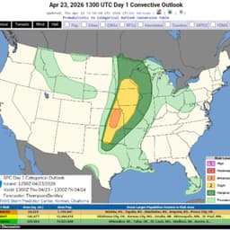
Chicago area. It's actually a two, 15 to 25 percent chance of seeing severe weather anywhere
within a 25 mile radius Thursday afternoon. That's the first day of Yantif here in Chicago.
Main risks will be damaging winds and large hail. But as we saw last time, at the very end,
there will probably be some type of a tornado risk as well, just very minor.
So these are drastic changes. They're really drastic changes from maybe in places in the south.
You can't really tell the difference between the two because there was so much gold moisture
with the system that it didn't really matter what the verimetric pressure was, perhaps. But when
you're looking up to the north, this makes an enormous difference. At least the way it's being
presented right now from what I'm seeing right now, it's very different from yesterday. And then
national weather service really does a phenomenal job in Minneapolis explaining how, you know,
whether there's cold air or not cold air, we could have a situation where there's enough evaporative
cooling and enough of other dynamics to bring down a three to six inch snow. They're actually saying
a four to six inch snow. And I think the weekend system, we're actually talking about solid cold
air that will be coming in, not much dry air in the atmosphere. So not as much evaporative cooling,
but the cold air comes in, the precipitation changes the snow. And that's where we're looking at
another major winter storm of six inches or more. We currently have a winter weather advisory
in effect portions the Minnesota. That's with the weather that we have right now. I hope to add some
more later on, but I wish everybody a wonderful day. We have a cold day here in Chicago, by the way,
Wednesday, air of Yanteth. Oh, and those, okay, those times. We'll get to them later. Maybe a
different episode. We'll get to all the times, but we have a cold day, especially in the north side,
temperatures in some areas might only hit 39 for the high. We have winds blowing off the icy lake.
And tomorrow, though, it's a, this is a big change where the current forecast is calling for
temperatures to go into the seventies. And then Shabbos right now, we're back into the warm air.
One would think since we're back into the warm air, we should be going back into the seventies.
We have to take a look at why the forecasts are only calling for highs in the low sixties.
That could change, but the colder air comes in on Sunday. The big spring weather pattern here is
the fact that you have high pressure off the mid-Atlantic area, which is going to be preventing
the cold front, even though it's the strong front over here. It eventually stalls the front
and it moves back north as a warm front. Whereas the sun, by Sunday, you have a washout front,
not a washout. It's the cold front remains strong and moves all the way off the coast.
That's more of a winter-type weather pattern, but the stationary front going all the way from
the plains, the mid-Atlantic area, with waves of low-pressured riding on that storm.
Friday, by the way, might be a break in the precipitation for many locations,
before the next storm comes on Shabbos. So, spring weather pattern this week, and at this point,
Chicago is even getting in on the spring warmth for several days,
Sunday, Monday, and then again on Thursday, and probably Shabbos as well. So, it's not just
the synoptic weather setup of a spring weather pattern. We're actually going to be feeling,
at this point, the forecast calls for us to be feeling spring weather for many days. Not all days,
we do have a lake and it's going to be raw, windy, and maybe even rainy tomorrow, but
but we have warm air currently being forecasted to push into the region on Thursday with
the sphere weather potential as well. I think it's unique. It's something that I'm not used to hearing
that the forecasters, at this time of the year, to one day here that the storm is relatively weak,
but the next day here that it's actually a strong storm developing and the pressure is significantly
more, it's already been the second or even third time that's been happening, and also the computer
models seem to under do the heat on the warm side. That's been another theme, another pattern
this year, something that we would have to look into to see why that keeps happening. At least in
the same Lewis area, they know beforehand it's going to happen. They know that the models are
underperforming, so they adjust the forecast, but for some reason here in Northern Illinois,
it doesn't seem to be known that something we're going to have to take a look at. Thank you for
listening. I wish everybody a wonderful day, have a hot culture of the Samakh, and perhaps we'll
have another episode later on where we truly will go over those times.