Record heat is headed into the St. Louis, Missouri area today.
This is the result of a historical high-pressure ridge, a heat dome over in the desert southwest,
which finally moves east, pushing its hot air into the Midwest.
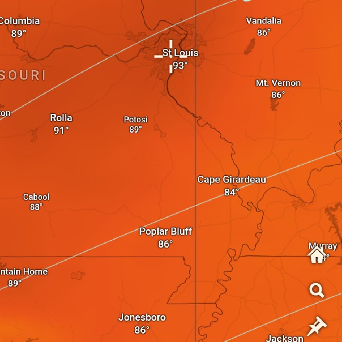
Computer models such as the European computer models show temperatures going into the 90s,
but here's the thing.
High temperatures according to the computer models glow 90s, so meteorologists, however,
are coming up with some spots and they go into the mid-90s.
The Lambert International Airport has a really good chance of hitting 94 degrees as a acu-weather.
This shatters the old record of 87 degrees.
Where do these mid-90s come from or even 93 lower 90s?
It has to do with the Ozarks.
Winds blowing off of the Ozark Plateau is expected to bring compressional warming and
drying the air, drying the dew points by a few degrees by the afternoon.
That's what's forecasted to happen and should that happen, those temperatures are going
to shoot up significantly higher than what's currently happening.
Currently, we have dew points in the low 60s in St. Louis, realize it's only March officially
a dew point of 60 or higher is considered human.
This year comes from the Gulf of Mexico.
As the air blows off the Ozark Plateau, dew point is a form of energy.
This sum becomes more efficient at heating dry air than humid air and those temperatures
are forecasted probably to hit 94 degrees at Lambert International Airport.
It's not the classic St. Louis heat and humidity.
It's more heat, some humidity this morning, but we do dry out this afternoon.
Thunderstorms, you know, tonight, it's interesting because usually a system like this would be
producing thunderstorms as a major cold front moves into the area.
Temperatures are actually forecasted to drop into the low 40s.
There's not enough upper forcing for there to be a high chance for thunderstorms this
evening, but should any storms develop, they will be strong, possibly even severe with
large hail being the main threat.
The National Weather Service tells us that all types of hazards are possible.
They're not forecasting it necessarily, but the time for these storms would be
after 90m and before 3am, the main thunderstorm activity will be happening after the front,
after the front moves through a very different story than usual, and then temperatures drop
super significantly after that.
High temperatures today are forecasted to be in the upper 90s and Phoenix mid 90s for
the official high in St. Louis, Missouri, but on officially all of those areas surrounding
that Lambert International Airport probably only the lower 90s, that's what I would think.
The icon model does show more of a 93-degree situation taking place.
I wish everybody a wonderful day and stay cool and stay safe, but I bet there will be tons
of people that are going to genuinely enjoy this heat.
We have lots of hot summer heat fans in the St. Louis area.
It's interesting if you look on AccuWeather, it actually brings the term baseball into
It says, a hot day for baseball, so that just gives more credibility for people who know
that St. Louis is a big baseball town, well, it's such a big baseball town that it even
makes it into the weather forecast.
I wish everybody a great day.
Thank you for listening.